Field notes: the coastline that added a thousand roofs between two renewals
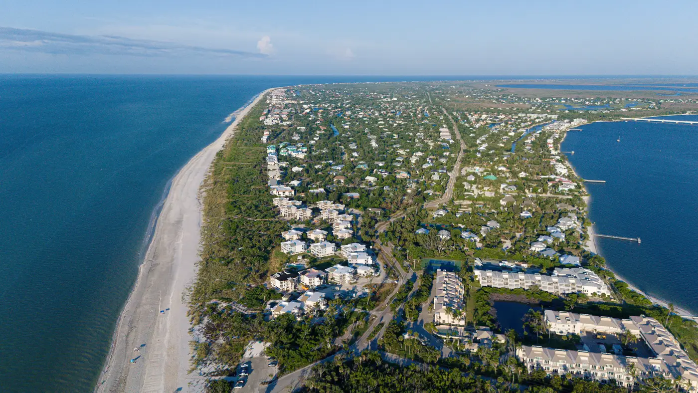
A broker sent over a renewal submission last month for a Gulf-facing book, the kind with a barrier-island segment that's been quietly filling in since the last hard market. The schedule looked fine on its face. Occupancy codes populated, TIVs within the range you'd expect for the zip, nothing that jumped out in QA. The kind of file you'd normally just load and move on.
What made me stop was the gap. Three years since the last renewal, and the schedule had grown by maybe four percent in item count. Four percent, on a stretch of coast where every permitting office in three counties has been running behind on inspections because they can't keep up with the volume of new construction. That didn't square.
So I pulled imagery instead of trusting the schedule to tell me what was there. Not a full reconstruction, just a look at footprint density along the same mile of shoreline across the two renewal dates. The difference wasn't subtle. Where the 2023 pass showed scattered lots and a handful of elevated beach houses on stilts, the current pass showed a near-continuous row of structures, most of them bigger than what they replaced, plus a cluster of new mid-rise condo buildings set back from the dune line that hadn't existed at all three years earlier. Call it a thousand roofs that the schedule never picked up.
None of this is unusual, and that's the point of writing it down. Self-reported schedules lag the physical world in a specific way: they update when someone remembers to tell the carrier, not when the building goes up. A developer buys out six lots, knocks down the cottages, and puts up twenty-four townhomes. The insurance paperwork for those units gets written fresh, sure, but it doesn't always route back into the same schedule that's feeding your cat model, especially if the new construction sits with a different agent or a different line of business entirely. Meanwhile the old TIV for those six lots is still sitting in your exposure data like the cottages never left.
Coastlines are where this shows up fastest because they're where the money is. Barrier islands, inlet towns, anywhere with a view premium, get rebuilt denser every cycle. A single-story frame house that survived one storm gets replaced after the next one with something three stories taller and twice the footprint, because the new owner can afford to build to the latest wind code and still come out ahead on square footage. That's the market behaving exactly the way coastal markets behave: rebuilding bigger and denser on the same lot every time the old structure comes down. The problem is that your exposure base doesn't know it happened until somebody goes and looks.
This is the gap a current built-inventory layer is built to close. Instead of waiting on the next round of schedule updates to catch up with what's already standing, you pull a fresh read of the footprints themselves, structure counts and rough form, off recent high-resolution imagery, and you compare it against what the treaty thinks is there. On a quiet book that comparison is a formality. On a stretch like this one, it's the difference between pricing the renewal on a wind field full of stilt houses and pricing it on the condo towers that actually sit there now. You can see how that comparison gets built for a territory or treaty here.
I don't think this particular mile is special. I think it's what a lot of coastal renewal books look like right now if anyone bothers to check, and most renewals get bound before anyone does. The schedule says four percent growth. The coastline says otherwise, and the coastline doesn't lie about what it's built.
Worth a second look before the next renewal lands on your desk.