What is accumulation risk, and why structure density matters at renewal
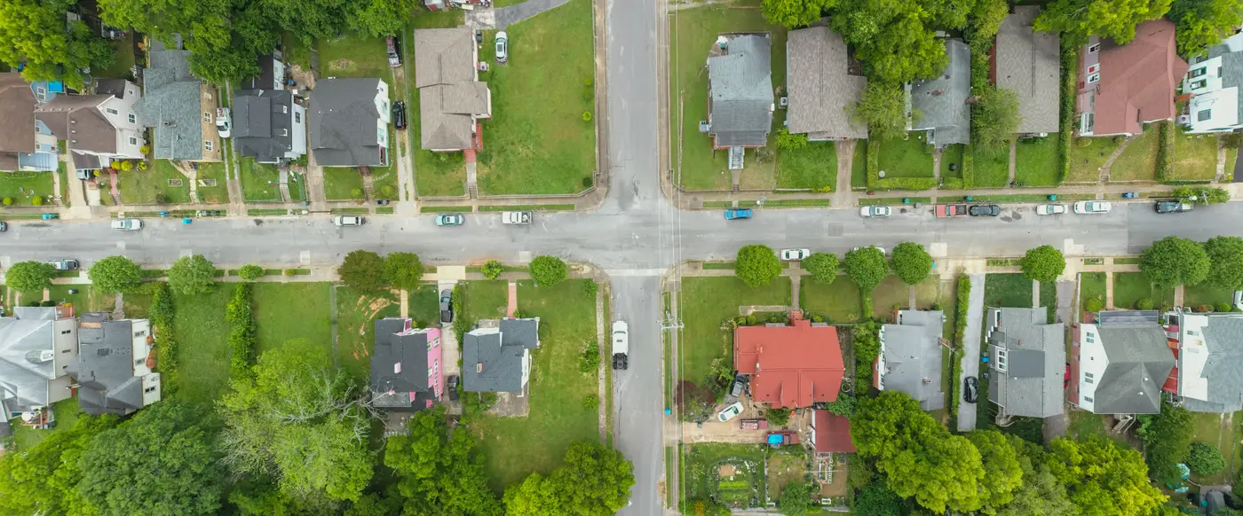
Accumulation risk is the gap between what a submission says is insured in a zone and what is really sitting on the ground there. The gap turns into a second-order problem the moment a storm or quake footprint crosses a few grid cells and the schedule turns out to have understated how much is packed into them.
Every treaty cedes risk on the assumption that exposure is distributed the way the data describes it. When that assumption breaks, loss accumulates faster than the model expected, and the layer that looked adequately priced at inception turns out to be undercapitalized by the time a cat hits.
Where accumulation risk hides in a submission
Schedules go stale for ordinary reasons. A cedant reports TIV by zip or CRESTA zone, not by address. Construction in a growing corridor gets added to the book months before anyone updates the locations file. A market rebuilds after a prior event and the new structures land on footprints the old schedule never had. None of this is fraud or negligence, it's just the lag between what gets built and what gets reported up through the chain to the broker and then to you.
The result is a submission that's internally consistent but geographically wrong. Your model runs fine on it. The PML comes out clean. But the zonal aggregate is smoothing over blocks where structure count tripled since the last valuation and other blocks where the book is thinner than the TIV implies. You're pricing an average, and averages hide exactly the concentration that drives tail loss.
This matters more for treaty renewal than for a single risk because treaty terms are written against the whole portfolio's accumulation profile, not any one building. A reinsurer setting attachment points and line sizes is making a bet about how loss clusters across the territory. If the underlying density is off by even a modest margin in the wrong cells, the attachment point that looked right at last renewal stops matching the concentration this cycle.
Structure density as the correction
Structure density, meaning the count and footprint of built inventory per grid cell, is the check that catches what a reported schedule can't. It works alongside TIV and the cedant's own valuations, giving you a second, independent read of what's physically there, built from current imagery rather than from whatever was last keyed into a locations file.
When density comes in higher than the schedule implies, that's your signal to go back to the submission and ask why. Maybe it's legitimate growth the cedant hasn't reported yet. Maybe it's informal construction that never makes it onto a schedule at all, which happens often in fast-growing peril zones. Either way, you want that answered before bind, not discovered in a loss run after the event.
When density comes in lower, that's useful too. It tells you the zone isn't as built up as the aggregate suggests, which can mean the attachment point has room you didn't know about, or that a prior year's schedule was carrying phantom exposure that's since been demolished or never materialized.
This doesn't replace the cedant's data. It gives you a way to stop treating a schedule assembled from self-reported, periodically updated records as if it were a current picture of the territory. Satellite imagery refreshed annually gives you a structure layer that doesn't depend on anyone remembering to report a new subdivision or a post-event rebuild. Loading that straight into the model, alongside the submission, is what Exposure Mapping is built to do: a current built-inventory layer for the treaty or territory you're renewing, derived from high-resolution imagery rather than stitched together from whatever schedules happen to be on file this cycle.
Accumulation risk doesn't announce itself in a submission. It sits quietly in the cells where the schedule and the ground have drifted apart, and it only becomes visible once you check structure density against what's on the ground. Worth doing that check before the renewal terms are set, not after.
If this year's renewal has you wondering what's been built out since the last valuation, that's the question Exposure Mapping is built to answer.